Crannog 6 Loch Awe[click on graphics for larger view in new window] |
Location: Larach Bŕn
Map reference: NN 073 228
Date of Survey: 26 September 1972
Loch level OD: 35.448 m
Highest point of crannog OD: 36.398 m
Top to bottom of crannog: 2.85 m
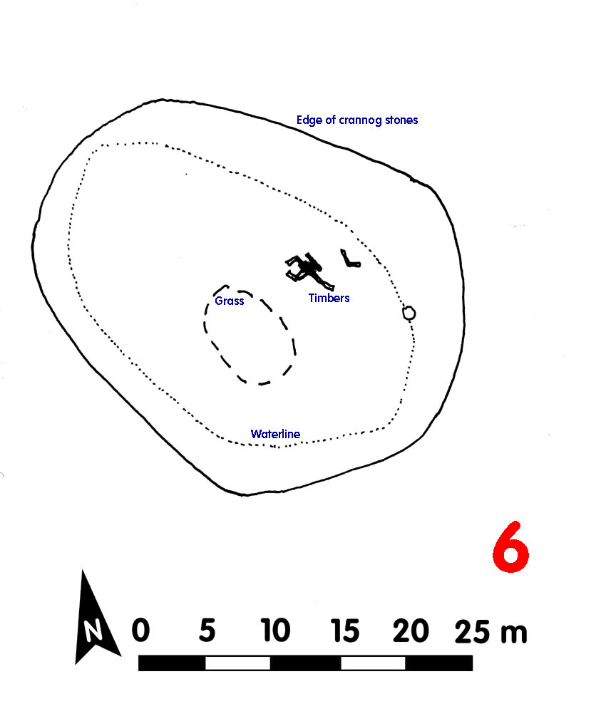
Overall spread: 34 m x 27.5 m
Usable area: 26 m x 15 m
Description (1972): Grass cover. Built along a natural ridge. Shore about 50 m distant to N
Area of overlapping timbers to E side of crannog, where timbers had been notched to take others lying on top of them
Finds:
Dating:
Post-1972:
CLICK TO ENLARGE

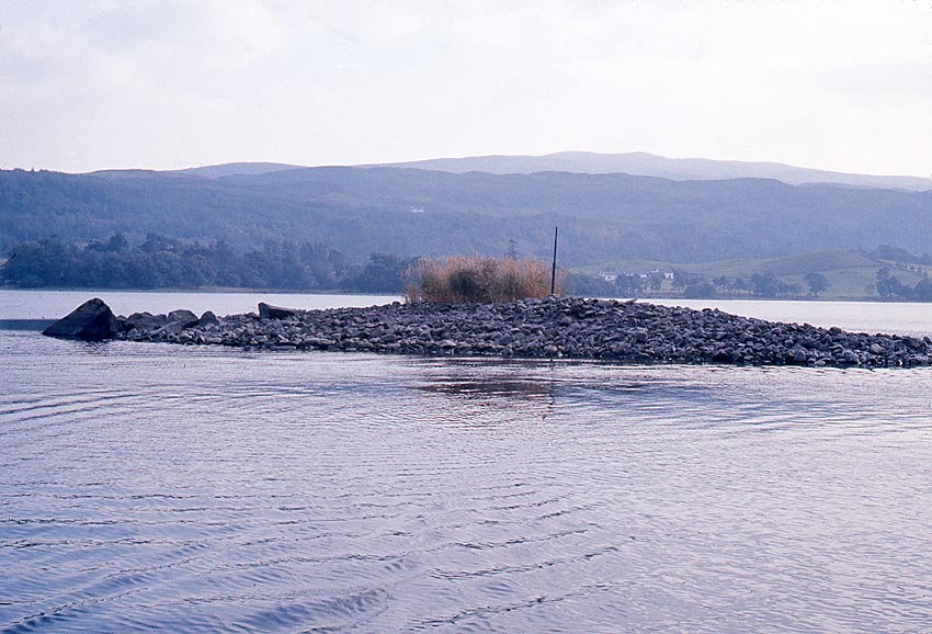
Crannog 6 (above and below, from opposite sides) sits on an underwater glacial ridge with projecting boulders
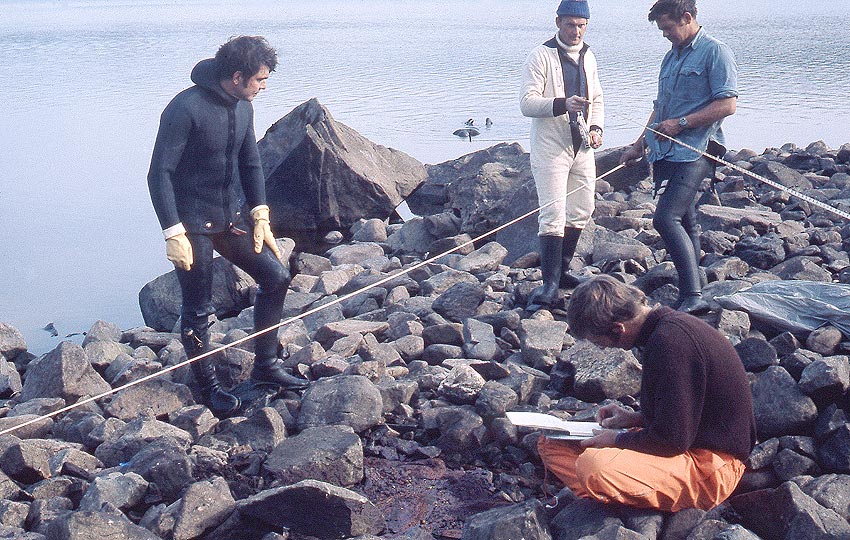
Modern survey systems can reduce personnel, but many eyes spot things: timbers are hard to see. Often the same colour as the stones, here overlapping baulks of timber are being recorded by Bill, 'Figgy' and John, Bryan observing . . .
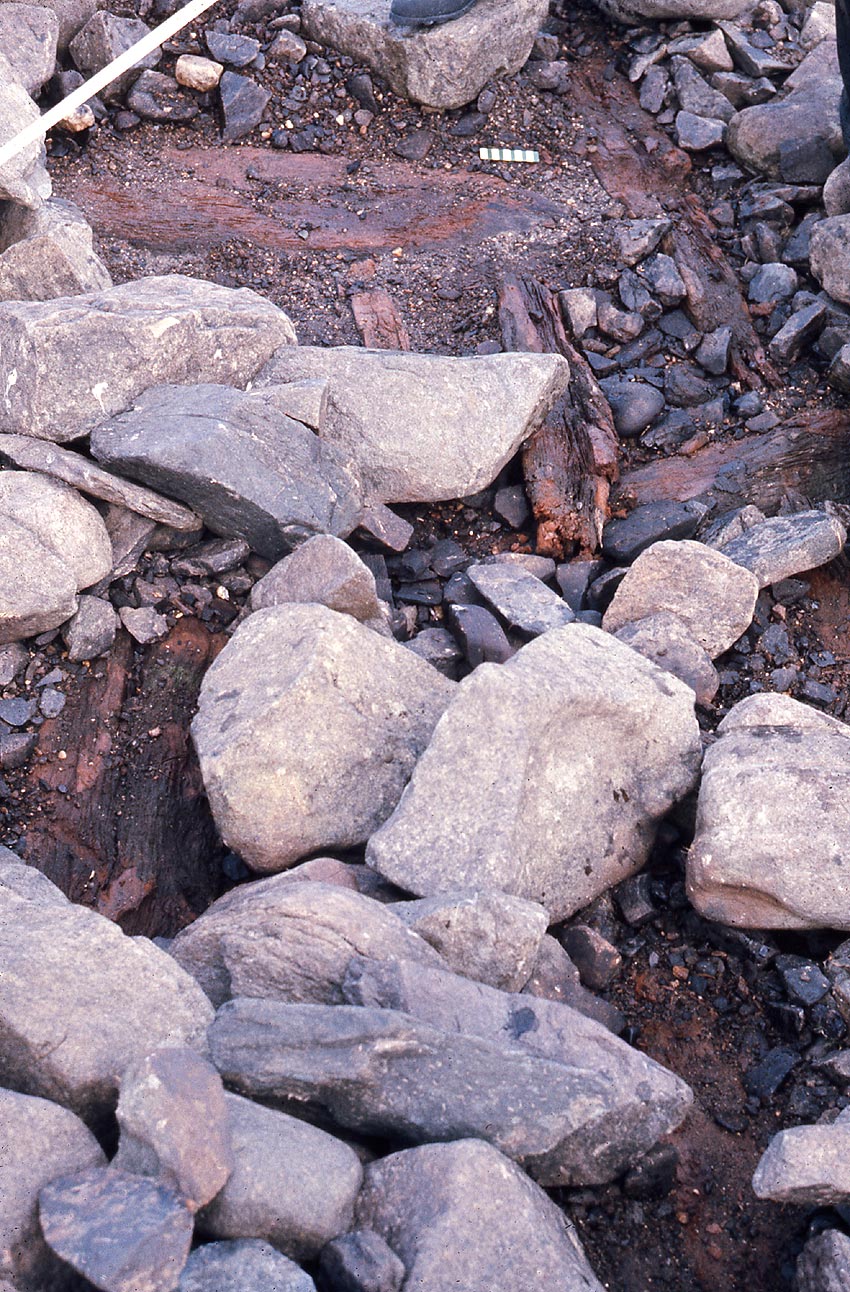
. . . the crossing timbers (10 cm scale) . . .
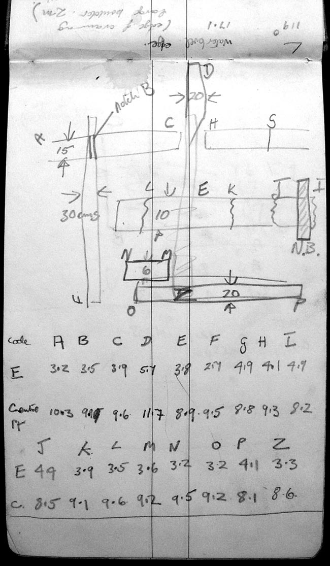
. . . and these are the entries, from the two tapes. Basic details; this was a field survey. You can only take so much time per item, even important finds; then off to the next target.
Back to front page